
Tianjin First-Time Guide: What to See and How to Plan
Plan a first visit to Tianjin with realistic timing, cultural context, priority landmarks, seasonal guidance, and routes that reflect the city's geography.
The short answer
Two full days can connect the Hai River core, specialist museums, neighborhood-scale architecture, and Tianjin food. Add a third day for the port, coastal wetlands, or outer-municipality heritage rather than treating every district as a central stop.
What to prioritize
Tianjin is a municipality of linked waters and sharply different districts: a dense river city, a Bohai port and industrial coast, canal towns and farmland, and the hills of Jizhou. A complete guide must move beyond the central skyline and treat all 16 districts as parts of one changing urban-region system. The Hai River and Grand Canal explain why settlement, grain transport, markets, maritime belief and later industry concentrated here. Bridges, railway stations, warehouses and the port are not background infrastructure; they are central evidence for how Tianjin grew and how residents continue to move. Tianjin's celebrated early-twentieth-century districts emerged through treaty-port and concession systems formed during conflict and unequal treaty relations. Their architecture is valuable evidence, but it should be read alongside colonial institutions, Chinese residents and businesses, later reuse, conservation and today's neighborhood life—not as a nostalgic imported stage set. Culture is equally material and performed: Yangliuqing printing, painted clay, xiangsheng, temple practice, breakfast stalls, industrial labor, libraries and museums involve different makers, institutions and audiences. Photographs and famous brands are starting points; living practice, access, price, safety and current conditions still require direct verification.
Hai River and its bridges
A continuous urban corridor linking old settlement, central districts, public space, rail, industry and the route toward the coast. Read each bridge by date, structure and present operation rather than as one timeless skyline.[3]
Jiefang Bridge
A riveted movable steel bridge beside Tianjin Station and former financial streets. Structural history, opening mechanism, traffic and night lighting are distinct layers and live operation must be verified.[5]
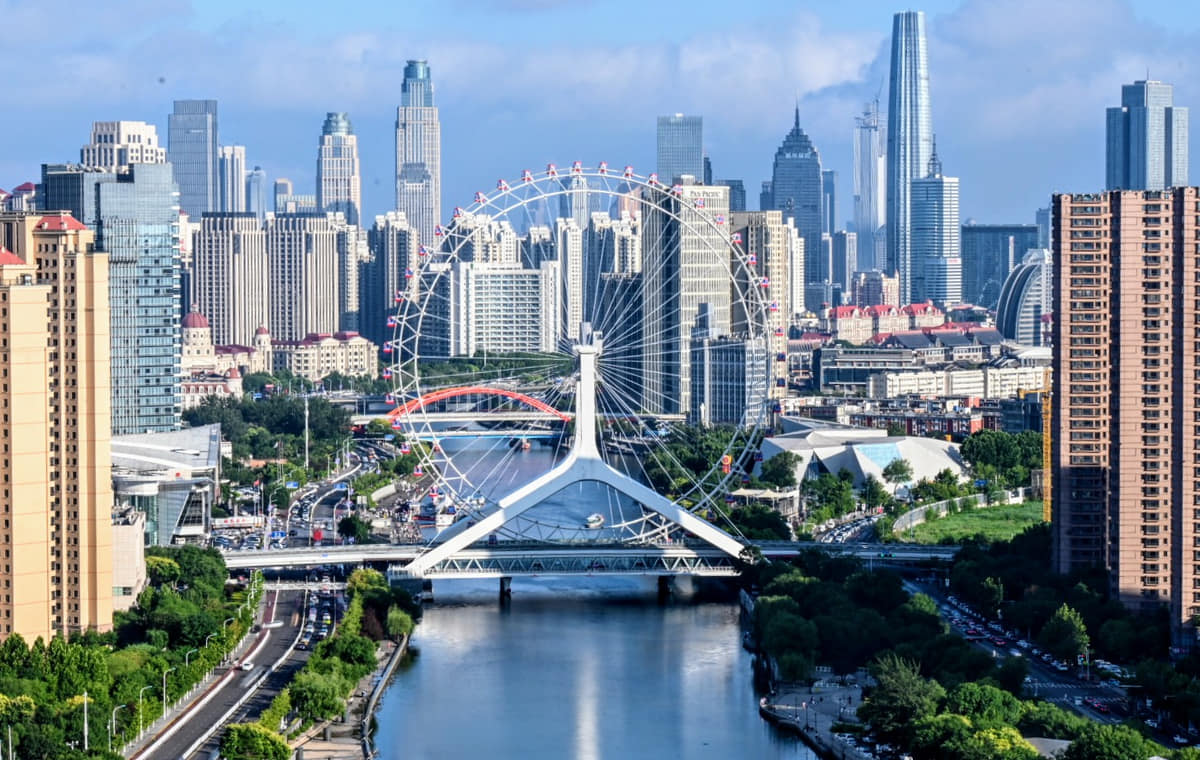
Tianjin Eye and Yongle Bridge
A Ferris wheel integrated with river-crossing infrastructure. Views, ticketing, weather limits, accessibility and operating hours are live conditions, not fixed facts in a city profile.[8]
Ancient Culture Street and Tianhou Palace
A commercial heritage district organized around a living Mazu temple and early river-junction settlement memory. Rebuilt shopping frontage and protected religious fabric require separate labels.[7]
Old city and Drum Tower area
The former walled-city grid survives through streets, archaeology, place names, rebuilt landmarks and neighborhood memory more than an intact wall. Maps and archival evidence are essential.[7]
Five Great Avenues
A 191.62-hectare historic district across Heping and Hexi with varied residential architecture and street space formed in the former British concession. Colonial context, later residents and present community use belong in the same account.[6]
Build a realistic first visit
- Group central architecture and museum visits by Hai River crossing because bridge approaches, security checks, and one-way streets can add more time than a flat map suggests.
- Treat the Five Great Avenues, Italian-style area, old commercial streets, and ordinary residential lanes as different historical settings rather than one visual category.
- Binhai, the port, wetlands, and coastal museums require a separate transport plan and should not be inserted casually into a compact central-city day.
- Use food formats to structure mornings and evenings, but verify opening times and ingredients because legacy names and online lists can outlast the businesses they describe.
Seasonal orientation
Spring
Dry air, wind, and rapid warming make layers useful; riverfront trees and neighborhood parks become active.[1][2][3][4]
Summer
Hot, humid weather and concentrated rainfall favor shaded streets, museums, and later waterfront walks.[1][2][3][4]
Autumn
Lower humidity and clearer days suit long walks through historic districts and along the Hai River.[1][2][3][4]
Winter
Cold, dry weather, wind, and indoor heating define the season; coastal areas can feel especially exposed.[1][2][3][4]