
Chongqing First-Time Guide: What to See and How to Plan
Plan a first visit to Chongqing with realistic timing, cultural context, priority landmarks, seasonal guidance, and routes that reflect the city's geography.
The short answer
Three days are the minimum for a useful first visit: one for the central peninsula, one for river crossings and vertical transport, and one for history or an outer-municipality landscape. Flat-map distances are misleading.
What to prioritize
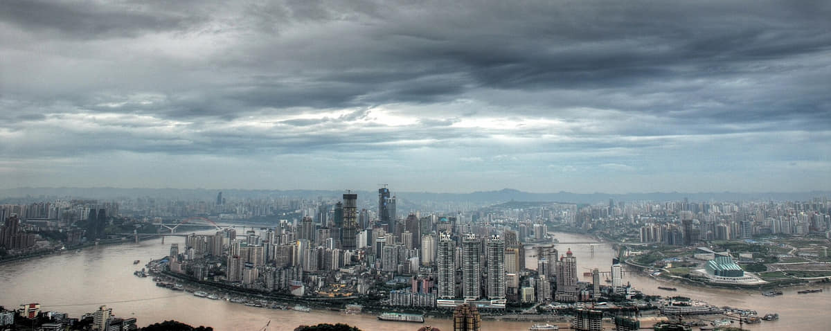
Chongqing is a municipality at provincial administrative level, not a single continuous downtown. Its current 37 county-level units—25 districts, 8 counties and 4 autonomous counties—stretch from the western basin and two-river core to reservoir shores, eastern gorges and southeastern Wuling Mountain communities. The 2025 adjustment created Liangjiang New Area, abolished Jiangbei and Yubei districts, and transferred five former Yubei towns to Beibei; maps and labels on this guide follow the post-adjustment structure. The famous vertical city is real but geographically narrow. Yuzhong and adjacent central districts compress ridges, rivers, bridges, rail, lifts, tunnels and layered streets, while Wanzhou, Fuling, Qianjiang, Wushan, Fengjie, Youyang, Rongchang and many other places have their own settlement patterns, economies, food systems and cultural institutions. A humid subtropical monsoon climate meets strong elevation and east–west variation. Hot humid summers, damp cloudy winters, fog, heavy rain, flood risk, heat, landslides and mountain weather are durable planning themes, but any day's temperature, river level, visibility, trail access and transport operation require live official checks. This guide separates what a photograph visibly documents from what sources establish. A museum display is not archaeological provenance; a rebuilt district is not untouched fabric; one stage role is not an entire tradition; one dish is not a canonical recipe; and a dated skyline, ferry, road or gorge view is not current access information.
Chaotianmen confluence
The Yangtze–Jialing junction explains peninsula form, port history, navigation, bridges, flood levels, shoreline works and changing skyline. Water and access are live conditions.[9][34]
Chongqing China Three Gorges Museum
The municipality's key orientation institution for archaeology, Ba-Yu, Three Gorges, migration, wartime collections and city history. Consult object labels and current opening notices.[13][14]
Jiefangbei
A wartime monument whose names, commemorative meanings, square-making and surrounding commercial centre changed over time. Monument, district and current retail should not be collapsed into one date.[19]
Huguang Guild Hall
A guild-hall complex linking migration, merchant associations, timber architecture, carving, theatre space, conservation and current museum use.[17]
Ciqikou historic district
A river-related historic district of lanes, slopes, buildings, residents, conservation, reconstruction and intense commerce. Visit beyond a single food street and respect lived space.[18]
Shibati
A steep route and renewed district where retained terrain, conserved remains, reconstruction, commerce, memorial layers and current crowds require careful separation.[11][34]
Build a realistic first visit
- Use landmarks, station exits, elevation, and river level together; a short horizontal distance can hide stairs, bridges, or multiple street decks.
- Do not schedule every skyline viewpoint. Choose one or two, then spend time inside ordinary streets and transit systems.
- Cableway, river cruise, and popular cave-area operations are live services with queues and weather dependence.
- Outer sites such as Dazu or Wulong require a dedicated day and should not be represented as central-city stops.
Seasonal orientation
Spring
Mild-to-warm weather, fog, and frequent rain make layered clothing and clear-weather viewpoints useful.[1][2][3][4]
Summer
Heat, humidity, thunderstorms, and intense sun require shade, hydration, and caution on long stair routes.[1][2][3][4]
Autumn
Shorter dry and clear periods favor river crossings, outer-district landscapes, and evening walks.[1][2][3][4]
Winter
Damp cool conditions, low cloud, and limited indoor heating make warm layers and museum routes practical.[1][2][3][4]