
Chongqing · Weather and seasons

Best Time to Visit Chongqing: Weather and Seasons

Compare Chongqing by season, including weather trade-offs, walking conditions, indoor alternatives, and the city experiences that change through the year.
Updated 2026-07-30Reviewed city sources
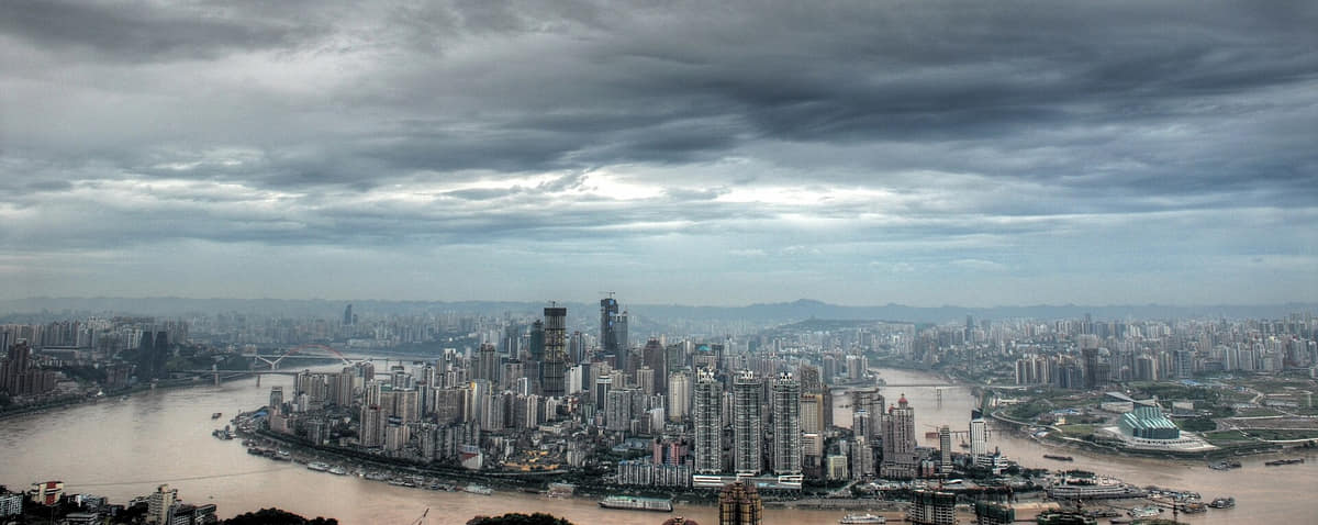
Documentary view of Chongqing
Photo: Oliver Ren · source · CC BY-SA 3.0

The short answer

Spring and late autumn usually provide the most comfortable urban walking. Summer is intensely hot and humid, while winter is cool, cloudy, and damp; fog and rain can transform views in every season.

Season by season

March–May

Spring

Mild-to-warm weather, fog, and frequent rain make layered clothing and clear-weather viewpoints useful.[1][2][3][4]

June–September

Summer

Heat, humidity, thunderstorms, and intense sun require shade, hydration, and caution on long stair routes.[1][2][3][4]

October–November

Autumn

Shorter dry and clear periods favor river crossings, outer-district landscapes, and evening walks.[1][2][3][4]

December–February

Winter

Damp cool conditions, low cloud, and limited indoor heating make warm layers and museum routes practical.[1][2][3][4]

How climate changes the plan

Humid subtropical monsoon climate

Summers are long, hot, humid, and often still; winters are damp and cool, with frequent cloud, fog, and rainfall shaped by basin and mountain terrain.[8][9][35]

  • Use landmarks, station exits, elevation, and river level together; a short horizontal distance can hide stairs, bridges, or multiple street decks.
  • Do not schedule every skyline viewpoint. Choose one or two, then spend time inside ordinary streets and transit systems.
  • Cableway, river cruise, and popular cave-area operations are live services with queues and weather dependence.
  • Outer sites such as Dazu or Wulong require a dedicated day and should not be represented as central-city stops.

Flexible city routes

Vertical core

Liziba → ridge streets → Jiefangbei → Hongya Cave

Use rail, lifts, stairs, and river overlooks to test how many apparent ground levels one route crosses.[1][2][3][4]

Two rivers

Chaotianmen → ferry or bridge → cableway → Nan'an

Read port history, confluence, bridges, banks, skyline, and everyday crossings from both sides.[1][2][3][4]

Municipal depth

Three Gorges Museum → Dazu, Wulong, or an eastern county

Pair central collections with one outer landscape to avoid treating the core as the whole municipality.[1][2][3][4]

Why Chongqing belongs in this collection

Chongqing adds mountain-and-river topography, vertical transport, layered streets, wartime memory, hotpot, and a vast municipality. This guide is a planning layer built from the city’s approved atlas profile rather than a booking or ranking page.

Read the complete Chongqing profile

More Chongqing planning guides

First-time guideThree-day itineraryFood guide

Sources and review

Last content update
Image verificationImage rights and place accuracy are approved.
Map verificationMap license, version, and administrative code are verified.

Numbered reference sources

  1. Chongqing Statistics Bureau — 2025 statistical bulletin
  2. Chongqing Municipal Government — city profile
  3. Three Gorges Museum — official website
  4. UNESCO — Dazu Rock Carvings
  5. Chongqing 2025 statistical bulletin — end-2025 permanent population of 31.8726 million
  6. 2025 administrative adjustment — Liangjiang New Area, Beibei, and the abolition of Jiangbei and Yubei districts
  7. Current Chongqing profile — 25 districts, 8 counties and 4 autonomous counties
  8. Chongqing climate profile — humid subtropical monsoon climate, vertical variation and hazards
  9. Chongqing territorial spatial plan — mountains, rivers, reservoir area and municipal structure
  10. Chongqing historical chronology — Ba context, port opening, wartime city, industry and municipality
  11. Historic-city conservation plan 2021–2035 — municipal routes, historic areas, streets, towns, villages and buildings
  12. Chongqing industrial-heritage plan — port-opening, wartime, early industrialization and Third Front layers
  13. Three Gorges Museum — Ba-Yu, Three Gorges, migration, city and collection contexts
  14. 2025 Chongqing registered-museum list — institutions, locations, hours and transport references
  15. Dazu Rock Carvings — five clusters, ninth–thirteenth-century art and conservation
  16. South China Karst — Wulong and Jinfoshan components in Chongqing
  17. Huguang Guild Hall — migration, guild architecture, carving and present museums
  18. Ciqikou protection rule — terrain, river, street pattern, buildings and landscape
  19. Jiefangbei monument — construction chronology, wartime memory and later commercial district
  20. Yangtze River Cableway — 1987 infrastructure, heritage status and visitor context
  21. Chongqing Great Hall — 1950s civic architecture and protected status
  22. Baiheliang — hydrological inscriptions, underwater in-situ protection and museum interpretation
  23. Diaoyu Fortress — mountain-river defensive site, archaeology and conservation
  24. Baidi City–Qutang Gorge — western Three Gorges entrance, archaeology and current scenic-area context
  25. Sichuan opera — Chongqing safeguarding unit, five tune systems and performance practice
  26. Chuanjiang work songs — river labour, call-and-response forms and safeguarding
  27. Tongliang dragon dance — local forms, props, music and community participation
  28. Rongchang pottery — local clay, production sequence, vessel types and safeguarding
  29. Liangping woodblock prints — subjects, carving, colour printing and safeguarding
  30. Youyang Tujia hand-waving dance — place-specific communal dance and safeguarding
  31. Chongqing food index — hotpot, xiaomian and district-specific dishes
  32. Chongqing xiaomian service standard — noodles, seasoning, optional toppings and shop practice
  33. 2026 Yuwei 360 Bowls programme — current district food categories and public guide
  34. Public-space and heritage projects — Jiefangbei, Chaotianmen, Huguang Guild Hall and Hongya Cave
  35. Current visitor guidance — weather, road conditions, warnings, openings, crowds and undeveloped areas
Report a correction