
Land and water
This city-specific topic connects place, daily life, and the wider municipal landscape: Land and water.
Sichuan Province · Sichuan Province, Southwest China
A rainy mountain gateway where tea history, Qingyi River valleys, giant-panda habitat, Sichuan–Tibet routes, stone bridges, hydropower, and county-level altitude differences define everyday life.
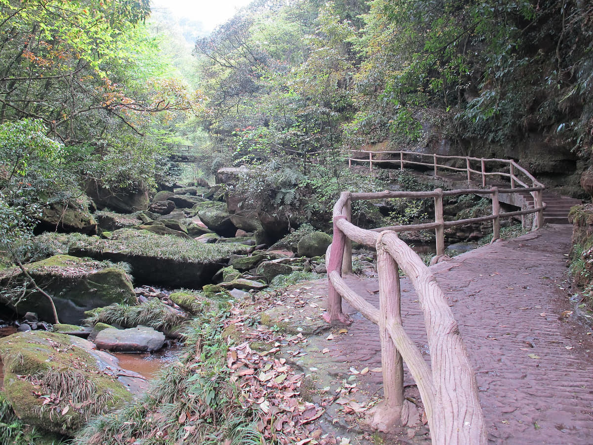
Ya'an occupies the western edge of the Sichuan Basin where the Qingyi River system, Dadu River valley, Qionglai and Jiajin mountain landscapes, narrow gorges, forest, cultivated slopes, reservoirs, and high relief meet. Frequent cloud and rain characterize many eastern valleys, while Hanyuan and Shimian can present markedly different, drier-looking valley conditions; one city-wide climate label cannot replace elevation- and watershed-specific weather.
The municipality contains eight county-level units with distinct evidence: Yucheng's river city, Bifengxia and Shangli; Mingshan's tea landscape; Yingjing's historic route, courtyards and forest valleys; Hanyuan's Dadu basin, Qingxi and pepper; Shimian's steep town, river confluence and high mountains; Tianquan's route towns and border-tea logistics; Lushan's Han towers and timber heritage; and Baoxing's Dengchigou, Qiaoqi and Jiajin biodiversity corridor.
Tea, fish, pepper, barbecue, cured foods, forest products, hydropower, roads, bridges, tourism, heritage, and conservation are systems of land, water, labor, regulation, risk, and household choice—not isolated brand icons. This guide distinguishes documented tradition from archaeological proof, protected habitat from animal display, a named product from verified origin, and a dated photograph from present conditions.
The editorial frame is cultural and geographic, not political. Modern memorials and public narratives are treated as evidence of memory institutions, inscriptions, routes, museums, and changing interpretation without endorsing a position. Claims that change—weather, opening, tickets, roads, reservoirs, wildlife access, food safety, and transport—must be checked with current responsible authorities.
This city-specific topic connects place, daily life, and the wider municipal landscape: Land and water.
This city-specific topic connects place, daily life, and the wider municipal landscape: Historical layers.
This city-specific topic connects place, daily life, and the wider municipal landscape: Living culture.
This city-specific topic connects place, daily life, and the wider municipal landscape: County diversity.
Thirty-six rights-cleared records cover all eight county-level units and have explicit place metadata. The wall connects river city, forest gorge, tea production, route heritage, industrial and hydropower edges, Dadu valleys, old towns, Han stone towers, timber buildings, food ingredients, highland water, natural-history interpretation, and biodiversity corridors. Captions distinguish visual evidence, source claims, dated conditions, and unresolved questions.
This city-specific topic connects place, daily life, and the wider municipal landscape: Qingyi River valley.[1][2][3][4]
Four geographic relationships define Ya'an.
This city-specific topic connects place, daily life, and the wider municipal landscape: Qingyi River valley.[1][2][3][4]
This city-specific topic connects place, daily life, and the wider municipal landscape: Sichuan Basin western edge.[1][2][3][4]
This city-specific topic connects place, daily life, and the wider municipal landscape: Hengduan mountain transition.[1][2][3][4]
This city-specific topic connects place, daily life, and the wider municipal landscape: Eight county-level units.[1][2][3][4]
Loading current conditions…
Forecast data: Open-MeteoPermanent residents across Ya'an Municipality
Population figures use the administrative area and source date shown below.[5]Frequent rain, cloud, and high humidity in eastern valleys give way to colder high mountains and deep elevation contrasts.
Climate describes long-term seasonal patterns; live conditions appear separately.[1][2][3][4]Temperatures rise quickly; rain, cloud, and local elevation call for flexible outdoor plans in Ya'an.[1][2][3][4]
Frequent rain, cloud, and high humidity in eastern valleys give way to colder high mountains and deep elevation contrasts.[1][2][3][4]
Clearer intervals and cooler evenings usually favor river, old-town, museum, and county routes.[1][2][3][4]
Damp cool conditions make layered clothing and indoor–outdoor route pairing practical.[1][2][3][4]
Ten sourced layers move from Fulin archaeology and Han stone architecture through tea traditions, route networks, living towns, nineteenth-century natural history, modern roads and public memory, hydropower and reservoirs, disaster recovery, and contemporary stewardship.
Fulin and related finds place early human activity within changing Dadu River terraces and mountain corridors. Assemblages, layers, dating, excavation history, paleoenvironment, collection storage, later disturbance, and scholarly interpretation must be separated; a scenic river view cannot stand in for archaeological context.[7]
Yandao's archaeological landscape and surviving stone funerary towers connect routes, county administration, elite burial, inscriptions, quarrying, transport, workshops, carved imitation architecture, and long conservation histories. Exact dates and monument relationships depend on inscriptions and archaeology, not visual style alone.[7]
Mount Mengding has a long documented tea tradition and later narratives associated with early managed cultivation. These are important cultural and textual histories, but phrases such as the world's first cultivated tea should be attributed as tradition or heritage claims unless supported by clearly defined archaeological evidence.[9][7]
Tea moved through gardens, workshops, grading, compression, storage, official and private institutions, carriers, pack animals where terrain allowed, inns, bridges, market towns, taxes, roads, and household consumption. The Tea-Horse Road was a changing network rather than one continuous unchanged trail.[7][8]
Market streets, courtyard houses, guild and ritual buildings, bridges, water systems, timber frames, tile roofs, stone paving, shops, farms, and route services evolved over multiple periods. Surviving, rebuilt, repaired, and newly traditional-style elements require component-level identification.[7]
Dengchigou is tied to Armand David's collecting and the international scientific description of the giant panda. Responsible interpretation avoids saying one outsider discovered an animal long known locally; it examines guides, hunters, translators, communities, specimens, institutions, naming systems, extraction, and later conservation ethics.[7][12]
Modern roads transformed human carrying, pack transport, market access, settlement form, labor, migration, and emergency response. Anshunchang's Dadu River landscape is interpreted through modern memorial institutions; the guide documents geography, surviving material, archives, museums, and multiple public-memory layers without political advocacy.[7][6]
Dams, power stations, transmission, highways, tunnels, rail, bridges, reservoirs, relocated or reorganized settlement, altered shorelines, irrigation, industry, and tourism reshaped county landscapes. Benefits, losses, ecological effects, safety, ownership, and household experiences require project-specific and community evidence.[5][6]
Earthquakes and mountain-water hazards have affected Ya'an's people, buildings, heritage, roads, utilities, and services. Interpretation should center verified event records, casualties with care, household displacement, repair decisions, accessible warning, schools and hospitals, workers, long-term recovery, and the difference between repaired appearance and structural safety.[7][5]
Contemporary stewardship joins tea-farming livelihoods, intangible-practice transmission, archaeological and building conservation, habitat connectivity, wildlife science, community rights, visitor capacity, public museums, film and education, climate adaptation, and transparent monitoring. Conservation is ongoing governance, not a finished scenic label.[5][8][12][11]
Seven perspectives center language and eight local settings; food and farm labor; river, road, power, construction, and services; community-specific traditions; knowledge and conservation work; wildlife responsibility; and unequal mobility and care—without inventing one Ya'an personality.
Standard Mandarin, Sichuan varieties, community languages, professional vocabularies, migration, age, education, and context shape speech across river city, tea district, market town, valley, highland, and village. No accent, ethnicity, or county name predicts personality, ability, income, or worldview.[5][6][7]
Tea growers and pickers, nursery and field workers, pepper growers, fruit and vegetable farmers, livestock and aquaculture workers, processors, graders, packers, traders, cooks, servers, inspectors, cleaners, and delivery workers form interdependent chains shaped by season, pay, gender, skill, contracts, weather, and safety.[5][6][7]
Hydrology and power staff, drivers, rail and road crews, bridge and slope engineers, construction and maintenance workers, shopkeepers, teachers, health workers, emergency teams, tourism staff, and public servants keep mountain settlements connected. Work conditions and risk vary by employer, route, altitude, weather, contract, and household responsibility.[5][6][7]
Tibetan, Yi, Han, and other residents live in specific neighborhoods, townships, villages, workplaces, schools, and mixed families. Language, clothing, food, architecture, ritual, farming, trade, music, and festival practice change by place and generation; they should be presented through named local voices, not a single ethnic template.[5][6][7]
Local historians, elders, craftspeople, tea makers, building carpenters, archaeologists, conservators, curators, archivists, translators, ecologists, rangers, veterinarians, animal-care staff, guides, filmmakers, teachers, volunteers, and residents produce different forms of knowledge. Expertise, authorship, consent, credit, wages, data access, and disagreement should remain visible.[5][6][7]
Living near protected habitat can involve land-use limits, crop or livestock risk, patrols, fire prevention, waste control, road rules, tourism pressure, compensation, ecological jobs, and pride as well as cost. Giant pandas are wild animals and conservation subjects—not props for human identity or guaranteed visitor sightings.[5][6][7]
Study, work, marriage, retirement, disaster recovery, seasonal labor, tourism, and family care connect Ya'an with Chengdu and other regions. Travel time, road closure, disability access, digital services, childcare, elder care, housing, income, gender, hukou, and health needs make the same mountain distance very different across households.[5][6][7]
Thirteen entries put Ya fish, Mengding green tea, dark and border tea, Hanyuan pepper, Shimian barbecue, Yingjing noodles and chicken, jar meat, Shimian chicken, cured foods, mountain plants, daily meals, and the whole food system within origin, technique, labor, safety, labeling, environment, affordability, and maker variation.
Menu name, fish species, legal farm or fishery source, supplier documentation, season, transport, live holding, water quality, slaughter, cold chain, kitchen separation, parasites, cooking temperature, bones, allergens, portion, price, and recipe vary. Protected waters and wild-fish rules matter; a famous name never proves legal local origin.[10][5]
Origin requires producer and batch evidence. Cultivar, elevation, picking standard, date, weather, field inputs, heat-fixing, shaping, drying, grade, storage, packaging, water, dose, temperature, infusion time, caffeine sensitivity, price, and maker style change the cup. Heritage recognition is not a blanket quality certificate.[9][10][11]
Producer terminology, material grade, heat and moisture, microbial conditions, pile or fermentation process, compression, brick size, packaging, warehouse humidity, age claims, contaminants, brewing, caffeine, labeling, and storage differ. Old-looking packaging or a route story does not verify age, safety, or authenticity.[10][11][8]
Species or cultivar, Qingxi or other place claim, orchard, altitude, harvest maturity, labor, drying, de-stemming, seed and foreign-matter removal, color, aroma, numbing intensity, moisture, mold, pesticide residue, packaging, storage, geographical-indication compliance, and retailer traceability need batch evidence.[10][5]
Skewers or griddles can include meat, poultry, offal, fish, tofu, mushrooms, vegetables, starches, chile, pepper, oils, and dipping mixtures. Supplier, slaughter and cold chain, raw-cooked separation, marination time, smoke and ventilation, doneness, hot holding, allergens, cross-contact, alcohol, late-night transport, price, and vendor style vary.[7][5]
Flour, water, salt or alkaline additions, resting, hand working, thickness, cooking time, broth, chile oil, pepper, meat or vegetarian toppings, greens, portions, wheat and other allergens, kitchen hygiene, hot holding, price, and shop rhythm vary. The name describes a local form, not one standardized recipe.[7]
Chicken source, slaughter, cooking, bone removal or joint cutting, cooling, knife and board separation, holding temperature, sesame, peanuts, chile, pepper, oil, sweetness, salt, portion, takeaway time, and maker style differ. Poultry must be fully cooked; a cold serving format does not reduce hygiene requirements.[7]
Cut, salting, cooking or frying, fat cover, vessel, seal, temperature, duration, opening, reheating, rancidity, microbial safety, sodium, portion, household practice, and commercial labeling vary. Historical preservation logic should be explained without treating all old methods as automatically safe under present conditions.[10]
Named-product registers document a local chicken product, but each menu claim needs breed or production evidence, farm, feed, animal health, medication records, legal slaughter, transport, refrigeration, cross-contamination control, core cooking temperature, bones, portion, price, and supplier traceability.[10]
Animal source, cut, salt and curing agents, smoke fuel, ventilation, soot and combustion exposure, temperature, humidity, drying time, mold assessment, storage, labeling, sodium, nitrite where used, slicing, cooking, cross-contact, and household or producer variation determine quality and safety.[7][5]
Species identification, legal access, protected-area rules, forager knowledge, harvest pressure, season, soil and water, cleaning, cyanogenic or bitter compounds in some shoots, toxic mushroom confusion, soaking or boiling, cold chain, market traceability, price, and medical advice matter. Never infer edibility from a photograph or local-looking stall.[5][12]
Rice, corn, noodles, potatoes, beans, tofu, eggs, greens, roots, fruit, meat, soup, tea, school and work canteens, hospital meals, home cooking, restaurants, takeaway, season, price, nutrition, allergies, religion, medical needs, age, time, and household labor describe daily eating better than destination branding.[5]
Fields, tea gardens, orchards, farms, aquaculture, slaughter, workshops, factories, warehouses, wholesale, wet and dry markets, shops, homes, restaurants, canteens, water, sanitation, ventilation, inspection, worker conditions, accessibility, affordability, delivery, packaging, leftovers, wastewater, smoke, compost, and refuse complete Ya'an's food story.[5]
Three routes pair the core city with contrasting county-level landscapes.
Moist mountain climate supports tea and forest habitat, while routes, farms, conservation rules, towns, and tourism determine how people live within it.
Read the story