A highland river-valley gateway where several languages and religious traditions, museums, markets, transport, food, universities, county agriculture, and mountain routes meet.
Huangshui valley, plateau gateway role, Kumbum Monastery, multi-community urban life, museums, noodles, yogurt, dry mountain edges, and county routes[1][2][3][4]
Guide scope
Seven county-level units spanning the urban valley, Huangzhong and Kumbum, Datong and Huangyuan, farms, county towns, forests, dry slopes, and highland transport routes[1][2][3][4]
Understand Xining through routes, communities, and highland environment
Xining sits in the Huangshui valley at the eastern edge of the Qinghai–Tibet Plateau. Elevation, dry mountains, river water, limited flat land, strong sun, and long-distance routes shape the city.
The capital brings together varied communities, religious institutions, museums, markets, schools, food traditions, workers, students, and travelers. Huangzhong, Datong, Huangyuan, farms, county towns, and mountain routes give the guide essential municipal depth.
Xining occupies a highland river valley at the meeting point of plateau and eastern agricultural corridors. Its compact urban districts connect to Huangzhong, Datong and Huangyuan through valleys, mountain roads, farms, monasteries, mosques, villages and county towns.
The guide distinguishes city institutions from province-wide collections and practices. Objects in Qinghai museums, regional foods and Tibetan cultural displays do not automatically originate in Xining.
Plateau gateway
The Huangshui corridor links eastern lowlands with the Qinghai–Tibet Plateau through transport, trade, migration, and institutions.
Multi-community capital
Languages, religions, neighborhoods, markets, work, education, and family histories create varied urban identities.
Highland environment
Elevation, strong sun, dry air, cold winters, river water, irrigation, and slope restoration shape settlement.
Specific cultural context
Museums and sites are useful only when communities, makers, dates, institutions, and contemporary change remain specific.
A visual record of the city
Eighteen locally hosted, rights-cleared images cover the central city, outer municipal areas, institutions, transport, daily space and food context. Captions distinguish city evidence from regional references and live conditions.
A dated valley street viewPhoto: Raki_Man · source · CC BY 3.0
A dated Xining night marketPhoto: Kelly Dombroski · source · CC BY-SA 4.0
Location, boundary, and 3D buildings
The core follows the Huangshui valley between dry mountains; the municipality extends through Huangzhong, Datong, Huangyuan, tributary valleys, farms, forests, county towns, monasteries, and high passes.[1][2][3][4]
A highland river valley, dry mountain edges, strong sun, limited flat land, gateway routes, and seven county-level units define Xining.
High plateau river basin
Xining occupies the Huangshui valley around 2,200 meters above sea level, enclosed by dry mountains and tributary valleys.[1][2][3][4]
Gateway terrain
Routes through the Huangshui valley connect eastern lowlands with the Qinghai–Tibet Plateau, making transport and exchange central.[1][2][3][4]
Dry climate and water
Limited rainfall, strong sun, cold winters, irrigation, reservoirs, river systems, and slope restoration shape settlement and agriculture.[1][2][3][4]
Seven units
Five districts, Huangyuan County, and Datong Hui and Tu Autonomous County span the core, Huangzhong, farms, mountains, county towns, forests, and highland routes.[1][2][3][4]
Population figures use the administrative area and source date shown below.[1][2][3][4]
Climate
Highland semi-arid continental climate
Elevation brings mild short summers, cold dry winters, strong ultraviolet exposure, large day–night temperature ranges, wind, and most precipitation in the warmer months.
Climate describes long-term seasonal patterns; live conditions appear separately.[1][2][3][4]
Seasonal patterns
March–May
Spring
Wind, dust, strong sun, cold mornings, and fast changes require layers, hydration, and sun protection.[1][2][3][4]
June–August
Summer
Days are mild to warm, nights cool, rain and thunderstorms increase, and highland ultraviolet exposure remains strong.[1][2][3][4]
September–November
Autumn
Clear dry periods, rapid cooling, and early frost favor valley and mountain views with warm layers.[1][2][3][4]
December–February
Winter
Cold dry air, freezing nights, snow or ice, strong sun, and possible inversions shape transport and outdoor time.[1][2][3][4]
A short history of the city
Huangshui settlement, long-distance exchange, religious and learning networks, transport, industry, public institutions, and contemporary regional services form distinct layers.
Roads, rail, industry, public institutions, housing, migration, education, and health services expanded the city.[1][2][3][4]
Plateau regional center
High-speed rail, aviation, services, universities, ecological restoration, new districts, tourism, and county links intensify the gateway role.[1][2][3][4]
River-valley exchange
Agriculture, pastoral movement, trade routes, religious institutions and fortified settlements connected plateau and eastern regions.[1][2][3][4]
Temples, mosques and urban markets
Religious and community institutions developed with markets, administration and routes; present buildings may include later reconstruction.[1][2][3][4]
Provincial capital and transport
Roads, rail, schools, hospitals, industry, housing and provincial institutions expanded the city along the valley.[1][2][3][4]
Highland metropolitan growth
New districts, rail and airport gateways, museums, universities, ecological work and county links now form a wider urban system.[1][2][3][4]
People, language, and everyday rhythms
Residents include Hui, Han, Tibetan, Tu, Mongol, Salar and other communities, urban and county households, students, workers, traders, farmers, migrants, and travelers.
Languages
Standard Mandarin, local Mandarin, Tibetan, Mongolic and other languages are used across households, markets, religious institutions, schools, and county communities.[1][2][3][4]
Multi-community city
Hui, Han, Tibetan, Tu, Mongol, Salar and other communities have varied histories, occupations, institutions, neighborhoods, and present-day identities.[1][2][3][4]
Gateway mobility
Students, traders, logistics workers, public employees, service staff, migrants, pilgrims, and visitors connect Xining with the plateau and eastern regions.[1][2][3][4]
Avoiding categories as stereotypes
Ethnic and religious identity intersects with generation, language, neighborhood, education, work, migration, and individual choice.[1][2][3][4]
Multiple communities
Han, Hui, Tibetan, Tu, Salar, Mongol and other residents contribute varied languages, religions, foods, work and family histories.[1][2][3][4]
City and county differences
Urban households, students, traders, industrial workers, farmers, herders and county residents should not be compressed into one highland personality.[1][2][3][4]
Culture and daily life
Image credits and licenses
Dongguan Mosque in 2025Photo: Michał Beim · source · CC BY 4.0
Markets, transport, museums, schools, religious institutions, food, and migration bring several cultural regions into the capital.[1][2][3][4]
Religious plurality
Buddhist monasteries, mosques, temples, community practices, calendars, learning, architecture, and everyday worship occupy specific contexts.[1][2][3][4]
Textiles and material arts
Thangka, embroidery, weaving, metalwork, woodwork, manuscripts, printing, and contemporary design require maker and community attribution.[1][2][3][4]
Medicine and knowledge
Medical traditions, museums, universities, clinics, research, translation, documentation, and contemporary regulation shape knowledge in use.[1][2][3][4]
Mountain and valley life
Irrigation, farming, herding, markets, seasonal work, slope greening, transport, and county movement connect environment with culture.[1][2][3][4]
Contemporary expression
Film, music, literature, visual art, design, social media, education, tourism, and urban work continually reshape representation.[1][2][3][4]
Kumbum in municipal context
Kumbum is in Huangzhong District within Xining Municipality; its religious importance, art and community life require institution-specific context.[1][2][3][4]
Plural religious landscape
Buddhist, Islamic, Daoist, Christian and other places belong to living communities and cannot be treated only as facades.[1][2][3][4]
Museums and provenance
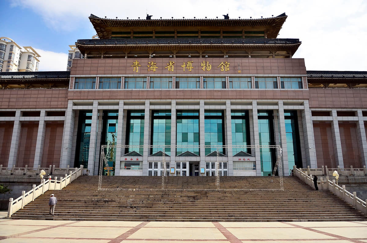
Qinghai Museum and Tibetan cultural institutions interpret province-wide histories; every object retains its own origin and catalogue context.[1][2][3][4]
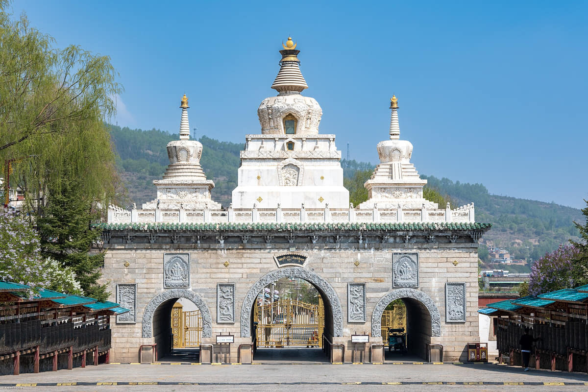
A major Huangzhong religious and learning landscape of architecture, pilgrimage, art, conservation, communities, and visitor management.[1][2][3][4]
Qinghai Provincial Museum
A starting point for plateau archaeology, ecology, trade, art, communities, research, conservation, and provincial context.[1][2][3][4]
Dongguan Mosque
A living urban religious institution connecting architecture, worship, Hui community histories, streets, commerce, and changing city life.[1][2][3][4]
Qinghai Tibetan Culture Museum
Collections and exhibitions on art, medicine, writing, material culture, research, conservation, and interpretation require critical context.[1][2][3][4]
Huangshui River corridor
River, irrigation, bridges, rail, roads, neighborhoods, industry, flood systems, and restoration explain the valley metropolis.[1][2][3][4]
Beishan and county routes
Dry slopes, religious sites, greening, views, farms, county towns, high passes, forests, and villages reveal municipal range.[1][2][3][4]
Kumbum architectural complex
A major religious, artistic and learning complex in Huangzhong whose buildings and practices belong to different periods and communities.[1][2][3][4]
Tulouguan
A cliff-side Daoist site that connects geology, built repair, religious practice and views over the modern city.[1][2][3][4]
Dongguan Mosque as a living institution
A living urban religious institution where facade history, community use and current access must be distinguished.[1][2][3][4]
Xining Railway Station
A plateau rail gateway linking the city with wider regional routes; schedules, security and transfers are live.[1][2][3][4]
Caojiabao Airport
An air gateway east of the core whose routes, ground transport and weather operations change.[1][2][3][4]
Highland valley skyline
A dated skyline makes the narrow basin and north–south slopes visible but cannot represent all seven county-level units.[1][2][3][4]
Ways to explore the city
Use institutions to build community context, read one valley cross-section, then travel to Huangzhong, Datong, or Huangyuan for municipal scale.
Plural city institutions
Dongguan Mosque → Qinghai Museum → Tibetan Culture Museum
Use three institutions to compare living worship, provincial collections, curated knowledge, architecture, and changing interpretation.[1][2][3][4]
Valley cross-section
Huangshui River → central neighborhoods → Beishan
Read irrigation, transport, density, dry slopes, greening, views, air conditions, and limited valley space.[1][2][3][4]
Municipal plateau
Core Xining → Kumbum → Huangyuan or Datong
Move from the capital to monastery landscape, farms, county towns, mountain routes, and varied community settings.[1][2][3][4]
Why is Xining best understood as a plateau crossroads?
A river corridor brings transport, trade, religious institutions, languages, food, students, county communities, and long-distance travelers into one valley city.