Guiyang is Guizhou's plateau capital, known for cool summers, karst landscapes, Jiaxiu Pavilion, Qingyan Ancient Town, rice noodles and sour-spicy food. This guide connects those highlights to all ten districts and counties.
Karst plateau, cool summers, Nanming River, Jiaxiu Pavilion, Qingyan, Guizhou regional cultures, food, data infrastructure, and forested hills[1][2][3][4]
Guide scope
Ten county-level units spanning the old basin core, Guanshanhu, Huaxi and Qingyan, Qingzhen, county seats, reservoirs, forests, farms, and karst countryside[1][2][3][4]
Guiyang travel guide: what to see, eat and understand
Guiyang is the capital of Guizhou and a prefecture-level municipality, not just the dense old core around Nanming River. Its ten current county-level units—six districts, three counties and Qingzhen—include old-city streets, Guanshanhu’s newer institutions, Huaxi wetlands and towns, industrial communities, lakes, county seats, karst valleys and rural settlements.
At the end of 2024, Guiyang had 6.6025 million permanent residents across the municipality. That number must not be confused with the central built-up area, Gui’an New Area, a wider metropolitan plan, registered population, students, commuters, tourists or transport passengers.
The city sits on the eastern Yunnan–Guizhou Plateau in humid subtropical monsoon conditions. Moderate annual temperature does not remove daily risks: rain, fog, strong ultraviolet exposure at elevation, wet stone, flash floods, heat spells and mountain-road conditions still require current forecasts and site notices.
This guide distinguishes city evidence from provincial context. A provincial museum object may come from Anlong; Guizhou batik is not automatically Huaxi embroidery; a ground-opera performance at Qingyan does not prove troupe origin; and a regional sour-soup dish served in Guiyang does not have one uncontested municipal origin or recipe.
Quick answers
What is Guiyang known for?
Guiyang is known for its mild plateau summers, karst landscapes, Jiaxiu Pavilion, Qingyan Ancient Town, Qianling Mountain, rice noodles and sour-spicy Guizhou food.
Where is Guiyang in China?
Guiyang is the capital of Guizhou Province in southwest China, on the eastern Yunnan–Guizhou Plateau. Its municipality includes six districts, three counties and Qingzhen county-level city.
What food should I try in Guiyang?
Start with siwawa, changwang noodles, Huaxi beef rice noodles, tofu balls and sour-soup dishes. Recipes and heat levels vary, so confirm ingredients and allergens at each venue.
Karst basin city
Limestone, limited flat land, short rivers, hills, caves, and rain explain urban form and county landscapes.
Cool-climate capital
Elevation moderates summer heat while humidity, cloud, rain, and damp winter conditions still structure daily life.
Regional cultural gateway
The capital gathers varied Guizhou communities and traditions but should not flatten them into one image.
Old and new basins
The Nanming old core and Guanshanhu show different eras of infrastructure, public space, housing, and institutional growth.
A visual record of the city
Twenty-seven locally hosted, rights-cleared images build Guiyang across river landmarks, historic and renewed streets, museums, wetlands, county gorges, transport, public architecture, craft comparisons and specific food views. Each caption states what the frame can and cannot support.
One Guiyang street momentPhoto: Caitriana Nicholson from 北京 ~ Beijing, 中国 ~ China · source · CC BY-SA 2.0
Location, boundary, and 3D buildings
The reference point sits near the old core, while the municipality extends through Guanshanhu, Huaxi, industrial districts, lakes, county seats, karst valleys and villages. One coordinate cannot locate the whole city.[1][2][3][4]
Karst limestone, plateau basins, short rivers, hills, reservoirs, and ten county-level units define Guiyang.
Karst plateau basin
Guiyang sits among limestone hills, depressions, caves, springs, and short river valleys on the Guizhou Plateau.[1][2][3][4]
Nanming River system
The Nanming and tributaries organize drainage, flood management, bridges, parks, older neighborhoods, and development corridors.[1][2][3][4]
Cool elevated climate
Elevation moderates summer heat but brings humidity, cloud, rain, rapid weather changes, and cooler conditions in outer counties.[1][2][3][4]
Ten county-level units
The municipality includes a dense basin core, Guanshanhu, industrial and university areas, Qingyan, county seats, farms, forests, reservoirs, and karst countryside.[1][2][3][4]
Permanent residents across Guiyang Municipality as a whole—six districts, three counties and Qingzhen county-level city; do not mix with the central built-up area, Gui’an New Area, a wider metropolitan plan or target, registered residents, students, commuters, visitors, tourists, airport or railway passengers
Population figures use the administrative area and source date shown below.[5][6]
Climate
Humid subtropical plateau monsoon climate
Elevation keeps summers comparatively mild, while cloud, rain, humidity, rapid weather changes, and damp cool winters remain characteristic.
Climate describes long-term seasonal patterns; live conditions appear separately.[8][7]
Seasonal patterns
March–May
Spring
Cloud, drizzle, warming, and rapid changes favor rain protection and flexible plans for stone paths and karst sites.[1][2][3][4]
June–August
Summer
Summers are generally milder than many lower-elevation southern cities, but heavy rain, humidity, and thunderstorms remain important.[1][2][3][4]
September–November
Autumn
Clearer intervals, cooler nights, and changing vegetation suit mountain parks, county routes, and long walks.[1][2][3][4]
December–February
Winter
Damp cold, low cloud, and occasional frost make warm waterproof layers more useful than temperature alone suggests.[1][2][3][4]
A short history of the city
Eleven sourced layers move from physical geography and archaeology through city formation, heritage, industry, transport and today’s ten-unit municipality.
Limestone terrain, basins, hills, caves, rivers and divides between larger drainage systems set the conditions for settlement, roads, water supply and flood management. Modern administrative borders do not define geological processes.[8][7]
Local place versus museum evidence
Provincial exhibitions place Guiyang within a much longer Guizhou chronology, but objects must retain their excavated locations. A bone ornament from Anlong displayed in Guiyang is evidence for museum interpretation, not a Guiyang find.[20][35]
No timeless administrative identity
Official chronology links the area to several regional entities and administrative systems before the Ming. Those names changed in territory and function and should not be projected unchanged onto today’s municipality.[9]
Administration reshapes the city
After Guizhou became a province in the Ming period, the settlement that became Guiyang gained a stronger administrative, military, economic and educational role. Walls, gates, schools and ritual buildings accumulated over later centuries.[9][13]
A town built and rebuilt
Qingyan began as a Ming military fort and later developed stone walls, lanes, homes and diverse religious buildings. Its present appearance contains historic fabric, later enlargement, conservation, reconstruction and tourism infrastructure.[14]
Late-Ming civic and learning landscapes
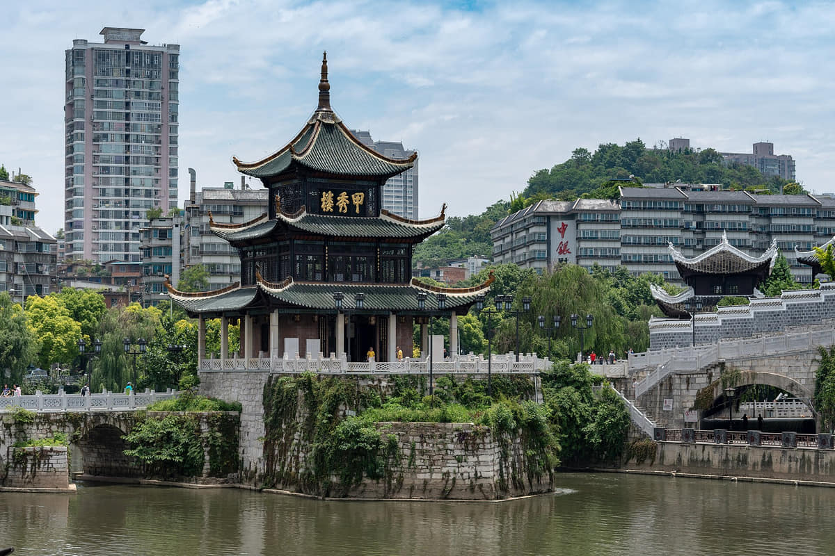
Jiaxiu Pavilion and Wenchang Pavilion anchor two different old-city relationships: one to the Nanming River and bridge system, the other to walls, gates and learning. Both have undergone repair and cannot be read as frozen first-build dates.[12][13]
Xiuwen as an intellectual site
Yangming Cave in Xiuwen connects Wang Yangming’s exile, study, teaching and later commemoration. Buildings, inscriptions, philosophical reception and twentieth-century history belong to different evidence layers.[18]
Government, markets, villages and faiths
The provincial centre, market routes, craft production, religious sites and surrounding Miao and Bouyei communities interacted without forming one uniform culture. Town and village histories need local records, not a single provincial label.[9][23]
From prefecture and county to city
Official chronology records the abolition of Guiyang Prefecture, creation of Guiyang County and establishment of Guiyang City in 1941. Each term describes a different administrative scale and should not be used interchangeably.[9]
New districts and working communities
Industry, education, rail, roads and housing expanded the city beyond the old basin core. Baiyun’s aluminium history, Huaxi’s institutions and later transport corridors produced distinct communities rather than one metropolitan experience.[9][33][15]
2012 adjustment and contemporary networks
The 2012 Huaxi–Xiaohe and Guanshanhu changes helped form the current structure. High-speed rail, metro, ecological projects, universities, industry and digital-economy institutions now connect—but do not erase—the ten units’ different landscapes and histories.[9][6][31]
People, language, and everyday rhythms
Eight perspectives preserve population scope, migration, language, work, city–countryside differences, climate and individual variation.
Population scope
6.6025 million permanent residents at end-2024 across Guiyang Municipality; not the downtown core, Gui’an, a future metropolitan target, registered residents or visitors.[5][6]
Ten-unit diversity
Life differs among six districts, three counties and Qingzhen: dense old neighbourhoods, new apartment areas, industrial communities, university zones, county seats, villages, lakes and mountain valleys are not interchangeable.[6][32][15]
Migration and growth
Recent population growth reflects migration, education, work, housing and policy, but does not establish a single newcomer story or permanent rate. Individual origins and residence histories vary.[5]
Language and identity
Mandarin, local Sinitic speech and Miao, Bouyei and other languages appear in different homes and places. Language, ethnicity, clothing, religion and occupation must never be inferred from appearance.[15][22][23]
Work and institutions
Public services, retail, food, transport, manufacturing, mining-related industry, education, tourism, construction, logistics and digital services support different schedules and neighbourhoods.[33][7]
City and countryside
Municipal residents include farmers, village artisans, town traders, industrial workers, students and office workers. A skyline or old street is not representative of everyone.[33][15][30]
Climate and daily planning
Cool-summer branding is not a personal medical guarantee. Rain, dampness, elevation, fog, wet stone, indoor conditions and individual health shape daily comfort differently.[8]
No city personality test
Food preferences, pace, friendliness, nightlife and outdoor habits differ by age, income, district, season and individual choice; cultural description should not become a stereotype.[5][6]
Culture and daily life
Image credits and licenses
Ground-opera troupe at QingyanPhoto: xiquinhosilva · source · CC BY 2.0
The capital hosts major provincial museums and performances, but location of display is not origin. Always preserve object, troupe and community provenance.[19][20]
Jiaxiu’s civic memory
Pavilion, bridge, river and garden connect water management, urban image, learning traditions and repeated conservation in the old core.[12]
Wenchang and the wall
Wenchang Pavilion, old gates and the renewed wall trail help reconstruct a city that is only partly visible in surviving fabric.[13][11]
Yangming learning sites
Yangming Cave and related city routes connect exile, study, teaching, later commemoration and current institutions; philosophy should be read through texts and dated places, not slogans alone.[18][30]
Huaxi Miao embroidery
Counted-thread and related embroidery techniques carry pattern, skill, social use and intergenerational teaching in particular Huaxi Miao communities. One textile cannot represent all Miao people.[24]
Batik is not embroidery
Wax resist, dyeing and cloth differ technically from counted-thread embroidery. A Guizhou batik photograph is included as comparison, not as proof of Huaxi production.[24][34]
Qingyan as a lived town
Fortifications, temples, churches, houses, shops and residents record long coexistence and change. Tourism should not flatten distinct beliefs or private space into scenery.[14]
Ground opera on a visitor stage
A troupe performing at Qingyan shows circulation of regional performance culture. Repertoire, ritual context and performer community require direct documentation.[14][34]
Zhenshan eco-museum
The village-scale museum model places stone architecture, domestic work, water, festivals and resident knowledge inside a living settlement rather than isolating objects in one building.[22]
Matou’s Bouyei architecture
Kaiyang’s Matou village preserves a built landscape of residences, ritual buildings, bridges and settlement planning. Protection status does not freeze residents’ lives.[23]
Renewal and authenticity
Taiping Road, wall trails and cultural blocks combine retained scale, repair, new construction, commerce and public facilities. Captions should name these layers instead of calling everything ancient.[10][11]
Contemporary cultural life
Museums, universities, roadside music, sports venues, markets and new public spaces form a contemporary layer. Programmes and venues change, so current schedules require direct checks.[35][34][30]
Food and local flavor
Fourteen entries treat local snacks and regional dishes as changing systems rather than endorsements or fixed recipes.
Image credits and licenses
SiwawaPhoto: Caitriana Nicholson from 北京 ~ Beijing, 中国 ~ China · source · CC BY-SA 2.0
One Guiyang street momentPhoto: Caitriana Nicholson from 北京 ~ Beijing, 中国 ~ China · source · CC BY-SA 2.0
Qingyan Ancient TownPhoto: xiquinhosilva · source · CC BY 2.0
Thin wrapper and vegetable fillings
Siwawa
Diners wrap shredded vegetables and add dipping liquid or seasoning. Ingredients, names, assembly and heat level vary; one photograph records a serving, not a canonical recipe.[25][28]
Intestine, blood curd and egg noodles
Changwang noodles
A rich broth, egg noodles, pork intestine, blood curd and chile oil are common motifs. Cuts, handling, toppings, allergens and shop practice must be confirmed directly.[26]
Broth-centred breakfast system
Huaxi beef rice noodles
Rice noodles, beef, broth, pickles, chile, herbs and spices form many clear, braised and sour variants. Brand claims and one official description do not make every bowl identical.[27]
Soy texture and frying
Tofu balls
Seasoned tofu is shaped and fried, then paired with chile, sour or aromatic dips in different styles. Oil, coagulant, filling, garnish and safe holding temperature vary.[25][28]
Regional fermentation in a capital-city table
Sour-soup dishes
Fish, beef and vegetables appear in sour broths associated with wider Guizhou communities. Presence in Guiyang does not prove one municipal origin, one ethnic ownership or one ferment.[25][29]
Strong aroma, heat and seasoning
Fermented tofu snacks
Grilled or fried tofu may be paired with chile, garlic, herbs and fish mint. Fermentation duration, microbes, oil, cross-contact and hygiene need vendor-level information.[28]
Town-associated braised food
Qingyan pig trotters
Braised trotters are strongly associated with Qingyan’s visitor food economy, but seasoning, producer history, sourcing, portion and current shop quality vary.[14][25]
Breakfast, markets and fast service
Rice noodles as daily infrastructure
Rice-noodle shops connect grain supply, broth work, early shifts, commuters and neighbourhood routines. Preferences differ across districts and households.[27][30]
An ingredient, not a personality test
Fish mint and aromatic condiments
Fish mint, coriander, garlic, chile, fermented bean products and pickles build many dipping sauces. Dislike or preference is individual and allergens or intolerances require direct questions.[28]
Preservation, microbes and seasonality
Pickling and sourness
Pickled greens, chiles and fermented liquids extend ingredients and create acidity. Household and industrial processes, salt, storage and food-safety controls are not interchangeable.[28]
Legume-based communal pot
Doumi hotpot
Soft beans thicken a shared pot that may include cured meat, vegetables and dipping sauces. Beans, broth, meat, sodium, allergens and portion vary by household and restaurant.[29]
Work, transport and social time
Night markets and late meals
Qingyun and other markets bring snacks, grills, drinks and delivery work together. Stall lists, opening hours, crowding, noise and hygiene are current conditions, not permanent traits.[30][31]
Agriculture behind the city table
County and village supply
Vegetables, chiles, beans, livestock, freshwater products and preserved foods move between rural Guiyang, county towns and central markets. Exact origin needs supplier evidence.[32][15]
Visible serving, limited claim
How to read a food image
A picture can show colour, cut, vessel and visible ingredients. It cannot prove origin, recipe, freshness, allergens, hygiene, dietary suitability, ethics, price or restaurant quality.[25][28]
A Nanming River complex of pavilion, bridge and garden, useful for reading water, old-city image, learning traditions and repeated conservation. Check current access separately.[12]
Wenchang Pavilion
A protected old-city pavilion with Ming origins, Qing rebuilding and a distinctive multi-angled roof, best read with surrounding wall and street fabric.[13][11]
Qingyan Ancient Town
A fort-derived stone town of walls, lanes, homes, religious buildings, residents, commerce and restoration. It is a living place, not one unchanging dynasty set.[14]
Qianling Mountain Park
An urban mountain of forest, paths, water, religious sites, recreation and wildlife. Follow current rules, keep distance from macaques and never treat wildlife as props.[17]
Huaxi National Urban Wetland Park
A connected wetland and public-space system including Shili Hetan, Huaxi Park and Pingqiao, shaped by karst water, recreation and active management.[16]
Guizhou Provincial Museum
The main provincial orientation institution for archaeology, history, palaeontology and cultural diversity. Read every object label for provenance rather than assuming Guiyang origin.[19][20]
Geological Museum of Guizhou
A province-wide geology and palaeontology institution located in Guiyang. Exhibitions explain plateau and karst contexts but individual specimens require catalogue data.[21]
Yangming Cave
A Xiuwen complex linking Wang Yangming’s Longchang period, caves, academies, inscriptions, later commemoration and twentieth-century history. These layers need separate dates.[18]
Zhenshan village
A Huaxi stone settlement and Bouyei eco-museum where architecture, domestic work, festivals, water and resident knowledge remain part of a living community.[22]
Matou village
A Kaiyang Bouyei village landscape of houses, ritual buildings, bridges and settlement organization. Heritage status should support residents rather than turn homes into anonymous scenery.[23]
Nanjiang River Gorge
A Kaiyang county landscape of river, steep karst terrain, bridges and trails that demonstrates municipal depth beyond the basin core. Weather and routes require live checks.[6][7]
Hongfeng Lake and Qingzhen waters
Lakes and reservoirs around Qingzhen connect water supply, ecology, settlement, industry and recreation. Shore access and water conditions change and require official notices.[32]
Tianhetan
A Huaxi karst attraction combining river, cave and managed visitor routes. Geology, lighting, boats, trails and commercial facilities are distinct layers; current access is operational information.[15]
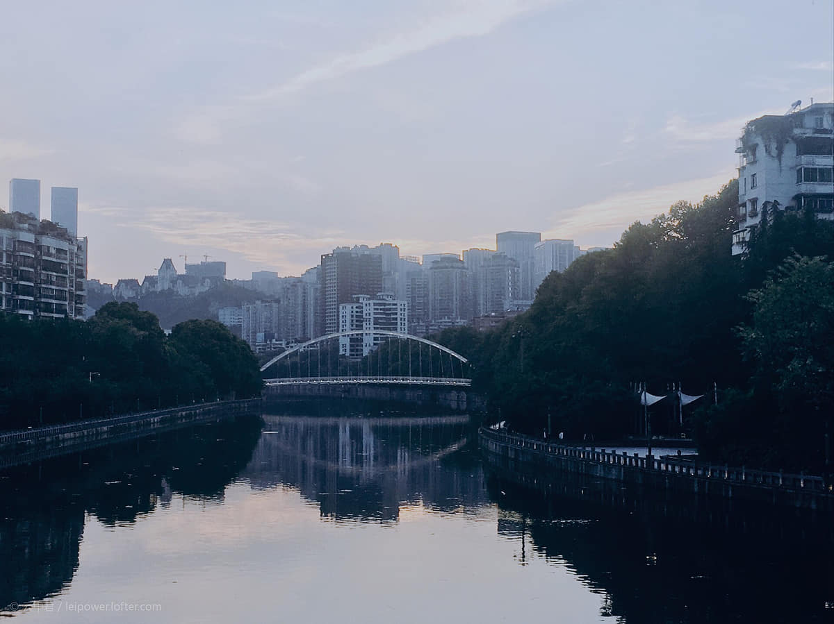
Nanming River corridor
The river links old-city landmarks, drainage, flood management, bridges, neighbourhoods and renewed public space. A scenic image is not a current water-quality report.[8][12]
Guanshanhu public landscape
Newer museums, parks, offices, housing, sports facilities and transit form a western urban layer that should be compared with—not substituted for—the old core.[7][6]
Guiyang North and the metro
High-speed rail and urban rail reorganize movement between city, province and country. Routes, timetables, accessibility and closures are live operational data.[31]
Old-city wall trail and Taiping Road
A contemporary public-realm project that layers surviving traces, interpretation, repair, new construction, commerce and everyday use. It should be labelled as renewal, not untouched antiquity.[10][11]
Ways to explore the city
Pair the Nanming old core with Guanshanhu and one southern or county route to understand geology, history, and municipal change.
River and old core
Jiaxiu Pavilion → Nanming River → old streets
Follow water, bridges, commerce, rebuilding, drainage, and neighborhood change through the historic basin core.[1][2][3][4]
Museum to new city
Guizhou Provincial Museum → Guanshanhu Park
Move from regional collections to a contemporary district shaped by government, housing, services, and digital infrastructure.[1][2][3][4]
Karst municipality
Qingyan → Huaxi → Qingzhen or a county route
Compare historic town, university-landscape corridor, reservoirs, farms, county seats, and karst countryside.[1][2][3][4]