Changchun is Jilin Province's capital, known for China's automobile and film industries, long snowy winters, Jingyuetan forest, difficult twentieth-century history and an eleven-unit municipality. This guide connects the map, weather, food and main sights.
Automobile manufacturing, film, Jingyuetan, sculpture, broad avenues, winter, and research institutions[1][2][3][4]
Guide scope
The central planned city, 11 county-level units including Gongzhuling, industrial districts, the Yitong River, and agricultural plain[1][2][3][4]
Changchun city guide: film, cars, winter and the wider municipality
Changchun is a large municipality on the Songliao Plain, not only a planned central city. Its seven districts, one county and three county-level cities connect the Yitong River, built-up core, industrial zones, reservoir forests, towns and major agricultural land. The end-2024 permanent-resident count was 9.0851 million, a municipal total rather than the population of the visible downtown alone.
Production institutions are central to the city's modern form. Film studios, automobile plants, rail-vehicle manufacturing, universities and research institutes generated work, housing, schools, transport and public identity. A complete account therefore looks beyond finished products to labor, supply chains, neighbourhoods, engineering and institutional change.
The city's twentieth-century architecture includes difficult occupation history. From 1932 to 1945, Changchun was renamed and planned as the capital of the Japanese-controlled puppet state of Manchukuo. Surviving compounds and avenues should be interpreted with colonial rule, coercion, war, loss, later reuse, restoration and museum practice kept visible rather than admired as style alone.
Strong seasons shape the daily city. China Weather describes long cold winters, short warm summers with concentrated rainfall, windy springs and clear autumns with large day–night differences. This climate helps explain winter maintenance, heating, enclosed circulation, summer park use, reservoir forests and food preservation, while live weather and safety still require date-specific information.
Quick answers
Where is Changchun in China?
Changchun is the capital of Jilin Province in northeast China, on the Songliao Plain. Its municipality includes seven districts, one county and three county-level cities.
What is Changchun known for?
Changchun is known for automobile manufacturing, film production, universities and research, the former Japanese-controlled puppet-state palace site, winter life and Jingyuetan's reservoir forest.
What is winter like in Changchun?
Changchun has a long, cold and generally dry winter, with heating, snow and short daylight shaping daily routines. Live temperatures, ice, wind and access conditions should be checked for specific dates.
Production city
Film and automobiles shaped technology, labor, housing, and public identity.
Planned city
Several planning regimes left broad avenues, institutions, green space, and difficult historical questions.
Winter metropolis
Climate affects transport, building use, food, recreation, and urban vegetation.
Agricultural municipality
The provincial capital is embedded in a much larger plain of farms, towns, and county-level cities.
A visual record of the city
Twenty-seven locally hosted, rights-cleared images connect current and historic transit, orbital and street-level city form, winter neighbourhoods, forest and river landscapes, difficult occupation heritage, film and automobile production, institutional relocation, public art and food. Captions separate dated scene, restored fabric, museum display, corporate claim, regional reference and live information.
Image credits and licenses
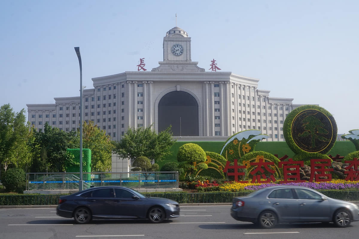
Changchun Railway Station in 2023Photo: Jacob Lyu · source · CC BY-SA 4.0
Changchun at night from orbitPhoto: NASA Johnson Space Center · source · Public domain
The central city lies on the Songliao Plain around the Yitong River, while the municipality extends across major agricultural areas and county-level cities.[1][2][3][4]
Permanent residents across Changchun's eleven county-level units
Population figures use the administrative area and source date shown below.[6]
Climate
Humid continental monsoon climate
Winters are long, very cold, dry, and snowy; summers are warm and humid, with most rainfall concentrated in the warm season.
Climate describes long-term seasonal patterns; live conditions appear separately.[1][2][3][4]
Seasonal patterns
March–May
Spring
Snowmelt, wind, dry air, and rapid warming make streets change quickly; parks green later than cities farther south.[1][2][3][4]
June–August
Summer
Warm, humid conditions and most annual rainfall support dense greenery, farming, lakeside activity, and occasional storms.[1][2][3][4]
September–November
Autumn
Cool, clear weather and colored foliage arrive early; temperatures fall rapidly after October.[1][2][3][4]
December–February
Winter
Long cold weather, snow, ice, heating, and short daylight define transport, food, recreation, and building use.[1][2][3][4]
A short history of the city
Eleven evidence-led layers move from the pre-1800 plain through administrative foundation, rail growth, Japanese occupation and puppet-state planning, postwar transition, automobile and film systems, research, restructuring and today's eleven-unit municipality.
Image credits and licenses
Tongde Hall exteriorPhoto: xiquinhosilva · source · CC BY 2.0
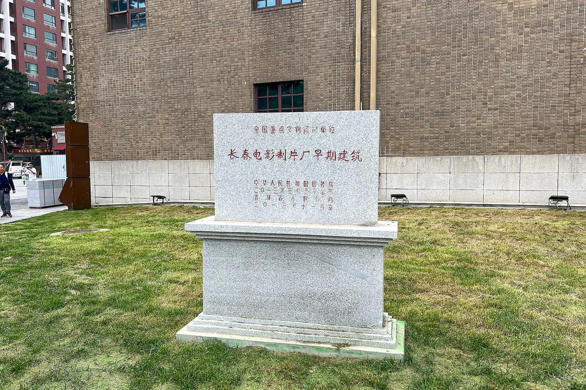
Heritage marker at the early studio architecturePhoto: N509FZ · source · CC BY-SA 4.0
FAW passenger-car plant exterior in 2024Photo: Lhzss8 · source · CC BY-SA 4.0
Former Jilin Provincial Museum building in 2011Photo: wanghongliu · source · CC BY-SA 3.0
Before 1800
Archaeology and regional records point to long human activity across the wider plain. Evidence belongs to specific sites and collections; it should not be compressed into an uninterrupted story of one present-day city center.[9][5]
1800–late 19th century
Official city history dates the establishment of Changchun Ting to 1800 and its later upgrade. This marks an administrative origin, not the beginning of all settlement or culture in the municipality.[9]
Late 19th century–1931
Railways, stations, workshops, commerce and migration accelerated urban growth and changed the relationship between the old town and newer transport districts. Different operators and political regimes shaped this infrastructure over time.[9][7]
1932–1945
Japan established and controlled the puppet state of Manchukuo and made the renamed city its capital. Grand avenues and administrative buildings were tied to colonial rule, coercive institutions, wartime extraction and unequal power—not a neutral planning experiment.[10][7]
1945–1948
The collapse of the puppet state was followed by Soviet occupation, institutional dislocation, civil war and severe urban hardship. Buildings changed users and functions; present museum narratives and later repairs are additional historical layers.[10][9]
1949–1950s
Changchun became the capital of Jilin Province in 1954. Administrative consolidation, housing, education, transport and public services accompanied postwar reconstruction and reshaped former occupation-era spaces.[9][5]
1953–1958 and after
First Automobile Works broke ground in 1953, began production in 1956 and expanded into a factory, supplier, housing and skills system. Heritage value and active corporate operations should be documented separately.[14]
1946 onward
The studio developed into a major film-production institution with stages, laboratories, archives, workers and public memory. The former-site museum interprets part of this system; a gate, stele or famous-film list cannot represent its whole labor history.[12]
Mid-20th century onward
Universities, optics, chemistry, geography, agriculture and engineering research strengthened the city's knowledge economy. Institutional mergers, campus histories and individual achievements need source-specific treatment rather than a single slogan of 'science city.'[5][7]
1980s–2000s
Market reform, enterprise restructuring, new development zones, housing change and service-sector growth altered factory-centered life. Continuity in brands or buildings does not mean unchanged ownership, employment or production practice.[5][7]
2020s
Today's municipality includes seven districts, Nong'an County and the county-level cities of Yushu, Dehui and Gongzhuling. The 2024 population total, map and city narrative use this eleven-unit scope, including extensive agricultural and county landscapes.[5][6]
People, language, and everyday rhythms
Eight perspectives describe 9.0851 million permanent residents through statistical scope, core–county differences, industrial and film labor, universities, agriculture, migration, language and seasonal routines—without assigning one personality to everyone.
Population is a municipal total
The 9.0851 million figure is the end-2024 permanent-resident count for all eleven county-level units. It should not be read as a downtown headcount or mixed with household-registration totals.[6][5][7][8]
Core, suburbs and county cities
Daily life differs among central avenues, older worker neighbourhoods, new districts, Shuangyang and Jiutai, Nong'an, and the cities of Yushu, Dehui and Gongzhuling. One urban personality cannot represent the entire municipality.[6][5][7][8]
Industrial work and skill
Automobile, rail-vehicle and equipment systems involve engineers, assembly workers, logistics, maintenance, suppliers, apprentices and service labor. Corporate output statistics do not describe working conditions or every worker's experience.[6][5][7][8]
Film and cultural labor
Cinema depends on directors and actors but also camera, lighting, set, costume, sound, laboratory, archive, restoration, exhibition and venue workers. Museum displays select from a much larger institutional history.[6][5][7][8]
University and research communities
Students, faculty, laboratory staff, technicians and graduates connect campuses with optics, vehicles, satellites, agriculture, medicine and services. Current programs and research claims require institution-level verification.[6][5][7][8]
Agricultural and county livelihoods
Corn, rice, livestock, food processing, logistics, local commerce and public services shape the wider municipality. Fields are working landscapes affected by weather, prices, mechanization, soil and household decisions—not empty land outside the city.[6][5][7][8]
Migration, language and cultural plurality
Standard Mandarin, northeastern speech, professional vocabularies and multiple family or ethnic traditions coexist. Korean-Chinese food and signage are visible within wider regional networks, but no restaurant or dish can stand in for a whole community.[6][5][7][8]
Seasonal routines
Heating, snow clearance, indoor circulation, winter transport, spring wind, summer parks and autumn temperature swings influence schedules and accessibility. Climate describes patterns; today's conditions require live weather and local checks.[6][5][7][8]
Culture and daily life
Image credits and licenses
Changchun Film Studio gate in 2017Photo: Antolavoasio · source · CC BY-SA 4.0
Entrance marker at World Sculpture ParkPhoto: Air7538 · source · CC BY-SA 4.0
Lotus water and stone bridge at South LakePhoto: Amarespeco · source · CC BY-SA 4.0
Changchun at night from orbitPhoto: NASA Johnson Space Center · source · Public domain
Planning with historical context
Broad avenues, roundabouts and axial buildings are visually distinctive, but many occupation-era spaces served a Japanese-controlled puppet state. Form, colonial power, wartime use, later reuse and conservation must be read together.[10][7]
Film as a production system
Changchun film culture includes studios, processing, sets, archives, distribution, cinemas, education and audience memory. A museum or themed attraction presents selected layers rather than a complete or politically neutral record by itself.[12]
Automobile city beyond brands
Factories, suppliers, testing, logistics, worker housing, vocational education and urban roads make the automobile system. Brand prominence should not erase labor, environmental impacts, restructuring or product change.[14][7]
Tram continuity and change
Route 54 makes transport history visible through old alignments, later vehicles and everyday service. Historic-looking cars may be replicas or rebuilt stock; current fares, fleet and accessibility require operator information.[15]
Sculpture, collection and copyright
World Sculpture Park combines landscape, outdoor works and museums. Each artwork has its own creator, date, material, provenance and reproduction status; an entrance photograph cannot substitute for an object catalogue.[13]
Museums as changing institutions
The provincial museum's move from People's Street to Yongshun Road shows why buildings, collections and institutions must be separated. Exhibitions rotate, provenance varies and current access changes.[16][17]
Research and technical culture
Optics, vehicles, rail equipment, satellites, agriculture and universities connect laboratories to manufacturing and public education. Technical achievements need dates, teams and institutional sources rather than generalized civic pride.[5]
Korean-Chinese and regional networks
Cold noodles, barbecue, bilingual signs and migration link Changchun with Yanbian and wider northeast Asian networks. These visible forms are diverse, commercial and personal; they should not be reduced to one fixed ethnic style.[19][5]
Winter as infrastructure, not decoration
Snow and ice affect heating, road treatment, vehicle operation, clothing, working hours and public-space access. Festivals are only one layer of winter life; safety and accessibility depend on current conditions.[8][15]
Parks, water and everyday recreation
South Lake, the Yitong River and Jingyuetan support different scales of walking, boating, transit, ecology and seasonal use. A scenic image is not a water-quality, biodiversity or safety assessment.[7][15]
County agriculture in the city story
Nong'an, Yushu, Dehui, Gongzhuling and outer districts connect grain, livestock, processing and logistics with urban consumption. Agricultural identity varies by locality and year; 'corn belt' is context, not a complete rural description.[5][6]
Labels, memory and contested interpretation
Names such as 'film city,' 'automobile city' and 'forest city' help orientation but are promotional frames. This guide keeps dates, sources, exclusions, visible evidence and uncertainty beside each label.[5][7]
Food and local flavor
Fourteen entries place guobaorou, dumpling reputation, winter stews, grains, smoked meat bing, cold noodles and barbecue inside regional circulation, recipe variation, allergen, traceability and live food-safety context.
Stews, fried dishes, pickled vegetables, pork, chicken, fish, wheat, rice, corn and potatoes appear in many combinations. These are shared regional systems with household and restaurant variation, not foods owned by one city.
Battered pork is fried and coated in a sweet-sour sauce, but cut, starch, sauce, color and crispness vary. Jilin authorities list it among regional classics; exclusive origin claims and one 'correct' recipe need stronger evidence.
The photographed storefront and plate show a visible old-brand narrative in Changchun. Founding dates, continuous ownership, recipe inheritance, awards and today's quality are separate claims that require documentary and live checks.
Fermented cabbage may be cooked with pork, ribs, blood sausage, noodles or potatoes. Acidity, salt, meat stock and portion vary, while fermentation and storage require careful food-safety practice.
Chicken, dried or fresh mushrooms, stock and sometimes noodles form a broad northeastern family of dishes. Mushroom species, wild sourcing, bones, salt and cross-contact should be checked rather than assumed.
The municipality's agricultural plain links corn, rice, wheat, millet and soy to porridge, breads, noodles and processed foods. A crop's regional importance does not prove the origin of every menu item or ingredient.
Sliced smoked or seasoned pork, layered bread, scallion and sauce form a portable regional meal. Brand stories cross Jilin cities, and the reference photograph was not taken in Changchun; location and continuity must be labelled precisely.
Chilled broth, buckwheat- or starch-based noodles, fruit, egg, meat, kimchi and sesame vary by shop. The foodway is associated with Korean-Chinese regional culture; one bowl cannot represent a community or fixed authentic recipe.
Skewers, sliced meats, vegetables, seasoning and grills create many northeast styles. Ask about meat identity, marinades, shared grills, doneness, ventilation, charcoal or gas, price and current hygiene.
Boiled, steamed or fried dough may contain pork, beef, lamb, seafood, egg, vegetables or mushrooms. Wheat, egg, soy, sesame and shared equipment matter for allergies and dietary requirements.
Porridge, buns, pancakes, eggs, soy drinks, pickles and seasonal produce connect neighbourhood stalls with household routines. Vendor, opening time, price, licensing and sanitation are live rather than permanent information.
Wheat, soy, sesame, peanuts, egg, dairy, seafood, meat stock, alcohol and shared oil or grills may appear even when not obvious. Vegetarian, vegan, halal, gluten and allergy needs require venue-level questions.
Changchun menus combine foods from Jilin, the wider Northeast and migration networks. Popularity in the capital is evidence of circulation, not automatic proof that the city invented or uniquely owns a dish.
A vivid photograph cannot verify sourcing, cold chain, fermentation, oil reuse, kitchen temperature, wages, permits or sanitation. Check current labels, storage, inspections, busy-service conditions and personal health needs.
A reservoir-and-forest landscape southeast of the core used for walking, cycling, skiing and seasonal recreation. The 2013 photograph is dated; current ecological, fire, water and access conditions require official updates.[7][15]
Museum of the Imperial Palace of the Manchu State
A museum built around the former palace site of the Japanese-controlled puppet state. Architecture, colonial rule, occupants, coercion, wartime systems, postwar reuse, restoration and exhibitions must remain distinct layers.[10][11]
Tongde Hall
A major building within the former palace compound whose mixed architectural language is visually prominent. Present surfaces, visitor circulation and displays include later restoration and museum use.[10]
Laixun Gate
A museum threshold now used by visitors. Gate fabric, restored components, inscriptions, security and access should be documented separately rather than treated as one unchanged historic object.[10][11]
Changchun Film Studio early architecture
Protected studio buildings connect cinema to stages, processing, offices and labor. The former-site museum interprets selected production history; political images and commercial presentation need contextual labels.[12][15]
Changying Cinema
A public-facing cinema in the studio precinct whose decorated facade records one phase of film branding and venue design. Current programme, operator and access are live information.[12]
First Automobile Works historic district
Early factory buildings, production infrastructure and associated neighbourhoods form an industrial-heritage system. Heritage precincts and active corporate sites have different access, evidence and safety requirements.[14][7]
World Sculpture Park
A large landscape and museum complex containing outdoor sculpture and several exhibition institutions. Individual artwork identification and reproduction need object-level catalogues and rights checks.[13]
South Lake Park
An extensive urban park where water, trees, bridges, boating and everyday recreation meet. Season, maintenance, water condition and operations change, so photographs remain dated evidence.[7][15]
Yitong River corridor
The principal river through central Changchun connects flood management, ecology, transport, housing and public space. Conditions vary by reach and date; a landscaped segment cannot represent the whole system.[7]
Route 54 tram
A surviving street-running tram route that makes transport continuity visible. Heritage-style vehicles, later cars, track condition, boarding, fares and accessibility require current operator information.[15]
Changchun Railway Station
A major railway gateway with a monumental south facade and contemporary transport functions. Architecture is visible; timetables, transfers, entrances, security and accessibility are live information.[7][15]
People's Square and Cultural Square
Two different central public spaces that help explain radial planning, institutions, roads, trees and civic use. The available photographs show partial street-level views, not complete plans.[7]
Jilin Provincial Museum
The current provincial museum is on Yongshun Road and holds collections from across Jilin. The 2011 gallery image shows a former People's Street venue and is explicitly labelled as relocation history.[16][17]
Jilin University and specialist museums
Campuses and geology, archaeology or art collections connect research, teaching and public interpretation. Current buildings, exhibitions and access should be checked with each institution.[16]
Automobile development zone
An active production and supplier landscape extending beyond protected early buildings. Corporate branding, industrial output, labor, logistics, emissions and public access require different evidence.[14][7]
County and agricultural landscapes
Nong'an, Yushu, Dehui, Gongzhuling and outer districts broaden Changchun through towns, fields, wetlands, logistics and food processing. They are lived and working places, not a blank hinterland.[5][6]
Ways to explore the city
Film, automobiles, difficult history, planned avenues, and forest landscape should be read together rather than as isolated attractions.
Film and automobile city
Film Studio Museum → automobile-industry context
Compare two production systems that shaped work, technology, housing, and national imagery.[1][2][3][4]
Difficult history and urban plan
Imperial Palace museum → preserved public buildings → central avenues
Read colonial rule through institutions, architecture, spatial planning, and museum interpretation.[1][2][3][4]
City and forest
Central Changchun → Jingyuetan
Move from broad avenues and institutions to the forest-reservoir landscape at the metropolitan edge.[1][2][3][4]